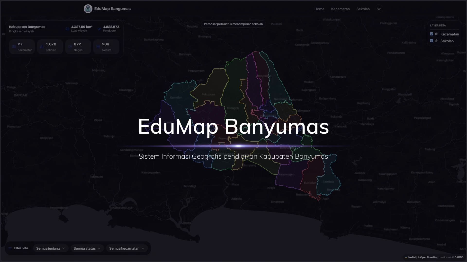
EduMap Banyumas
EduMap Banyumas maps school and district data for Banyumas Regency. Built as a rebuild of an existing GIS app, it gives the public a filterable map and searchable tables, while admins get a full dashboard for managing districts, schools, and users.
Design & Full Stack Development
August 27, 20263 min read
- Contribution
- Design & Full Stack Development
- Updated
- August 27, 2026
- Read
- 3 min
Inside the project
From intent to outcome
A closer look at the thinking, implementation, and decisions that shaped the final work.
EduMap Banyumas
EduMap Banyumas started as a rebuild of an existing GIS app for education data in Banyumas Regency. The older version had the core idea right: show schools and districts on a map, let admins manage the data behind it. I rebuilt it from Laravel 11, Bootstrap 5, and MySQL into a Next.js 16 App Router project so the codebase would be easier to maintain, stricter about data shape, and more suitable for my portfolio.
The Problem
School data has a spatial side that a plain table does not show well. You can search for a school by name or NPSN, but it is harder to understand how schools are spread across districts without seeing them on a map. Admins also need one place to manage districts and schools — with validation, authentication, image uploads, and clear feedback when something changes.
The tricky part was the map. React Leaflet does not play nicely with server-side rendering, and Next.js 16 App Router has its own conventions that differ from older Next.js patterns. I had to be careful about what belonged on the server and what had to stay client-only.
Building It
I started with the data model. Prisma stores regencies, districts, schools, users, sessions, passkeys, and rate limits in PostgreSQL. District geometry is stored as JSONB instead of PostGIS — this project needs mapping and CRUD more than heavy spatial analysis, so keeping the Neon setup simple made more sense.
The public map is built as a full-screen experience. The page fetches basic stats on the server: district count, school count, public schools, private schools. Leaflet components load through dynamic imports with SSR disabled. District polygons come from , with geometry simplified before it reaches the browser.
Screenshots
Interface details
Homepage
Homepage Zoom
Kecamatan Page
Sekolah Page
More selected work